Our website is made possible by displaying online advertisements to our visitors.
Please consider supporting us by disabling your ad blocker.
Rural Municipality of Deer Forks No. 232
Deer Forks No. 232 | |
|---|---|
| Rural Municipality of Deer Forks No. 232 | |
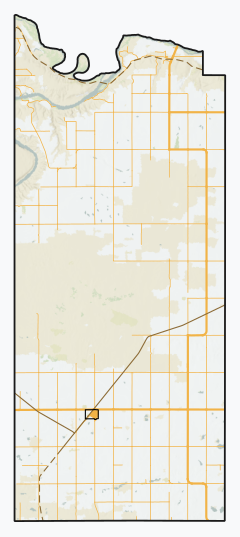
 Location of the RM of Deer Forks No. 232 in Saskatchewan | |
| Coordinates: 50°50′49″N 109°53′17″W / 50.847°N 109.888°W[1] | |
| Country | Canada |
| Province | Saskatchewan |
| Census division | 8 |
| SARM division | 3 |
| Formed[2] | January 1, 1913 |
| Government | |
| • Reeve | Doug Smith |
| • Governing body | RM of Deer Forks No. 232 Council |
| • Administrator | Kim Lacelle |
| • Office location | Burstall |
| Area (2016)[4] | |
| • Land | 736.26 km2 (284.27 sq mi) |
| Population (2016)[4] | |
| • Total | 109 |
| • Density | 0.1/km2 (0.3/sq mi) |
| Time zone | CST |
| • Summer (DST) | CST |
| Postal code | S0N 0H0 |
| Area code(s) | 306 and 639 |
| Highway(s) | Highway 321 Highway 635 Highway 741 |
| Waterway(s) | South Saskatchewan River |
| Website | Official website |
The Rural Municipality of Deer Forks No. 232 (2016 population: 109) is a rural municipality (RM) in the Canadian province of Saskatchewan within Census Division No. 8 and SARM Division No. 3. Located in the southwest portion of the province, it is adjacent to the Alberta boundary, neighbouring Cypress County to the west.
- ^ "Pre-packaged CSV files - CGN, Canada/Province/Territory (cgn_sk_csv_eng.zip)". Government of Canada. July 24, 2019. Retrieved May 23, 2020.
- ^ Cite error: The named reference
ruralincorpwas invoked but never defined (see the help page). - ^ "Municipality Details: RM of Deer Forks No. 232". Government of Saskatchewan. Retrieved May 21, 2020.
- ^ a b Cite error: The named reference
2016censusSKmuniswas invoked but never defined (see the help page).
Previous Page Next Page


