Our website is made possible by displaying online advertisements to our visitors.
Please consider supporting us by disabling your ad blocker.
Gulf of Ob
| Gulf of Ob | |
|---|---|
| Обская губа (Russian) | |
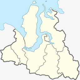
 Map showing the location of the Gulf of Ob. | |
| Location | Far North |
| Coordinates | 68°50′N 73°30′E / 68.833°N 73.500°E |
| River sources | Ob |
| Ocean/sea sources | Kara Sea |
| Basin countries | Russia |
| Average depth | 10–12 m (33–39 ft) |
| Official name | Islands in Ob Estuary, Kara Sea |
| Designated | 13 September 1994 |
| Reference no. | 676[1] |

The Gulf of Ob (Russian: Обская губа, romanized: Obskaya guba), also known as the Bay of Ob (Russian: Обский залив, romanized: Obsky zaliv), is a bay of the Arctic Ocean, located in northern Russia at the mouth of the Ob River.[2] It is the world's longest estuary.[3]
- ^ "Islands in Ob Estuary, Kara Sea". Ramsar Sites Information Service. Retrieved 25 April 2018.
- ^ "Gulf of Ob". www.eosnap.com/ Earthsnapshot.com. Archived from the original on 2012-03-20.
- ^ "Longest estuary". divingalmanac.com. Archived from the original on 2019-02-07. Retrieved 2019-02-05.
Previous Page Next Page


