Our website is made possible by displaying online advertisements to our visitors.
Please consider supporting us by disabling your ad blocker.
Flora, Norway
Flora Municipality
Flora kommune | |
|---|---|
 View of Florø | |
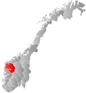
 Sogn og Fjordane within Norway | |
 Flora within Sogn og Fjordane | |
| Coordinates: 61°35′15″N 05°16′38″E / 61.58750°N 5.27722°E | |
| Country | Norway |
| County | Sogn og Fjordane |
| District | Sunnfjord |
| Established | 1 Jan 1964 |
| • Preceded by | Kinn, Florø, Bru, Eikefjord, and Vevring |
| Disestablished | 1 Jan 2020 |
| • Succeeded by | Kinn Municipality |
| Administrative centre | Florø |
| Government | |
| • Mayor (2015-2019) | Ola Teigen (Ap) |
| Area (upon dissolution) | |
| • Total | 693.06 km2 (267.59 sq mi) |
| • Land | 647.51 km2 (250.01 sq mi) |
| • Water | 45.55 km2 (17.59 sq mi) 6.6% |
| • Rank | #163 in Norway |
| Population (2018) | |
| • Total | 11,988 |
| • Rank | #96 in Norway |
| • Density | 18.5/km2 (48/sq mi) |
| • Change (10 years) | |
| Demonym | Floraværing[1] |
| Official language | |
| • Norwegian form | Nynorsk |
| Time zone | UTC+01:00 (CET) |
| • Summer (DST) | UTC+02:00 (CEST) |
| ISO 3166 code | NO-1401[3] |
Flora is a former municipality in Sogn og Fjordane county, Norway. It was located in the traditional district of Sunnfjord. The administrative centre was the town of Florø, which was founded in 1860. Florø has 8,957 inhabitants (2017) and the Eikefjord area in the east has 387 inhabitants (2017).[4] Other village areas in the municipality included Rognaldsvåg, Stavang, Grov, Norddalsfjord, Nyttingnes, Steinhovden, and Brandsøy.
At the time of its dissolution in 2020, the 693-square-kilometre (268 sq mi) municipality was the 163rd largest by area out of the 422 municipalities in Norway. Flora was the 96th most populous municipality in Norway with a population of 11,988. The municipality's population density was18.5 inhabitants per square kilometre (48/sq mi), and its population had increased by 5.1% over the last decade.[5][6]
The municipality stretched from inner fjords where the mountains ascend to the Ålfotbreen glacier, to the outermost islands off the mainland coast. The town at its centre had industries that developed continuously. Trade and industry in Flora were mainly fishing industry, shipyards, and supply for the oil and gas industry in the North Sea.
- ^ "Navn på steder og personer: Innbyggjarnamn" (in Norwegian). Språkrådet.
- ^ "Forskrift om målvedtak i kommunar og fylkeskommunar" (in Norwegian). Lovdata.no.
- ^ Bolstad, Erik; Thorsnæs, Geir, eds. (26 January 2023). "Kommunenummer". Store norske leksikon (in Norwegian). Kunnskapsforlaget.
- ^ Statistisk sentralbyrå (1 January 2016). "Urban settlements. Population and area, by municipality".
- ^ Statistisk sentralbyrå (2018). "Table: 06913: Population 1 January and population changes during the calendar year (M)" (in Norwegian). Retrieved 13 October 2019.
- ^ Statistisk sentralbyrå. "09280: Area of land and fresh water (km²) (M)" (in Norwegian). Retrieved 13 October 2019.
Previous Page Next Page


