Our website is made possible by displaying online advertisements to our visitors.
Please consider supporting us by disabling your ad blocker.
Fort St. John
| Fort St. John | ||
|---|---|---|
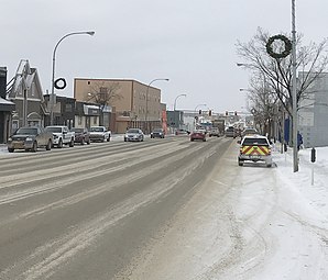
 Downtown Fort St. John | ||
| Lage in British Columbia | ||
| Staat: | ||
| Provinz: | British Columbia | |
| Regionaldistrikt: | Peace River | |
| Koordinaten: | 56° 15′ N, 120° 51′ W | |
| Höhe: | 690 m | |
| Fläche: | 26,27 km² | |
| Einwohner: | 20.155 (Stand: 2016[1]) | |
| Bevölkerungsdichte: | 767,2 Einw./km² | |
| Zeitzone: | Mountain Time (UTC−7) | |
| Postleitzahl: | V1J | |
| Bürgermeister: | Lori Ackerman | |
| Website: | www.fortstjohn.ca | |
Fort St. John, seltener auch Fort Saint John geschrieben, ist eine Stadt im Peace River Regional District der kanadischen Provinz British Columbia. Die Stadt hat auf einer Fläche von 22 km² 18.609 Einwohner (Schätzung 2011).[2] Sie befindet sich bei Meile 47 des Alaska Highway und ist neben Fairbanks und Whitehorse eine der größten Städte an dieser Überlandstraße.
Der erste Vorgängerort entstand 1794 als Handelsplatz (trading post) und ist damit die älteste europäische Gründung im heutigen British Columbia. Bereits 1948 wurde das zwischen 1806 und 1896 genutzte Gelände mit den Gebäuden zur National Historic Site of Canada erklärt.[3]
Der Slogan der Stadt lautet heute Fort St. John: The Energetic City (dt. Die Stadt voller Energie).
- ↑ Fort St. John Community Profile. Census 2016. In: Statistics Canada. 9. August 2019, abgerufen am 1. September 2019 (englisch).
- ↑ Census agglomeration of Fort St. John, British Columbia. In: Focus on Geography Series, 2011 Census. Statistics Canada, abgerufen am 20. September 2015.
- ↑ Fort St. James National Historic Site of Canada. In: Canadian Register of Historic Places. Abgerufen am 26. Mai 2018 (englisch).
Previous Page Next Page


