Our website is made possible by displaying online advertisements to our visitors.
Please consider supporting us by disabling your ad blocker.
Le Boisle
| Localització | |||||
|---|---|---|---|---|---|
| |||||
| Estat | França | ||||
| Entitat territorial administrativa | França Europea | ||||
| Regió | Alts de França | ||||
| Departament | Somme | ||||
| Districte | Districte d'Abbeville | ||||
| Cantó | Cantó de Crécy-en-Ponthieu | ||||
| Població humana | |||||
| Població | 333 (2021) | ||||
| Geografia | |||||
| Superfície | 11,68 km² | ||||
| Altitud | 12 m-92 m | ||||
| Limita amb | |||||
| Identificador descriptiu | |||||
| Codi postal | 80150 | ||||
| Fus horari | |||||
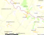
Le Boisle és un municipi francès situat al departament del Somme i a la regió dels Alts de França. L'any 2007 tenia 373 habitants.
Previous Page Next Page


