Our website is made possible by displaying online advertisements to our visitors.
Please consider supporting us by disabling your ad blocker.
Kuhmoinen
| Kuhmoinen | ||||
 Armoiries |
||||
 Le parc national d'Isojärvi. | ||||
| Administration | ||||
|---|---|---|---|---|
| Pays | ||||
| Région | Finlande-Centrale | |||
| Langue(s) parlée(s) | finnois | |||
| Démographie | ||||
| Population | 2 201 hab.[1] (31.12.2021) | |||
| Densité | 2,3 hab./km2 | |||
| Géographie | ||||
| Coordonnées | 61° 33′ 43″ nord, 25° 10′ 41″ est | |||
| Altitude | Min. 78 m Max. 201 m |
|||
| Superficie | 93 668 ha = 936,68 km2 [2] | |||
| · dont terre | 660,94 km2 (70,56 %) | |||
| · dont eau | 275,74 km2 (29,44 %) | |||
| Rang superficie | (118e / 336) | |||
| Rang population | (264e / 336) | |||
| Histoire | ||||
| Province historique | Häme | |||
| Province | Finlande occidentale | |||
| Localisation | ||||
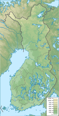
| Géolocalisation sur la carte : Finlande
Géolocalisation sur la carte : Finlande
Géolocalisation sur la carte : Finlande centrale
| ||||
| Liens | ||||
| Site web | http://www.kuhmoinen.fi | |||
| modifier |
||||
Kuhmoinen est une municipalité du centre-sud de la Finlande, dans la région de Finlande-Centrale.
- (fi) « Väestötietojärjestelmä Rekisteritilanne 31.08.2012 », Centre finlandais du registre de la population (consulté le )
- (fi) « Superficie par municipalité au 1er janvier 2011 », Maanmittauslaitos (consulté le )
Previous Page Next Page


